 The Dead Sea may live up to its name within 30 years. It is dying. Evaporating at a rate of one meter every three years, the world’s saltiest body of water is threatened by a lack of fresh water and the lack of political will to enforce environmental change. In another three to five decades, the evaporating Dead Sea is likely to become completely dry.
Surrounded by the fraught political situation of Israel, Jordan and the Palestinian West Bank, the Dead Sea is the lowest land point on Earth. It is called the Dead Sea because nothing can survive in its salty water. Its only source of life is fresh water from the Jordan River. Because it is so low, it has no exit points. The Dead Sea water evaporates, causing salts to accumulate in the lake and in its sediments. It is this unusual buoyancy that makes the Dead Sea a major tourist drawcard as it is impossible to swim or sink in its salt-rich deposits. It is also renowned for the unique mineral content of its mud which attracts health spa tourism.
But the Jordan River is no longer able to supply its lifeblood to the Dead Sea. Gideon Bromberg of Friends of the Earth Israel told AFP the area is headed for ecological disaster unless serious measures are taken. Only 7% of the Jordan River water flow is now making it as far as the Dead Sea. The rest is diverted for irrigation and drinking water, mostly by Israel but also by Jordan and Syria. In the 1950s about 1.3 billion cubic meters of water a year flowed into the Dead Sea. The flow is now down to 300 million. Scientists have monitored the sea’s water level continuously since 1930. The sea has declined 21 metres between 1930 and 1997 which represents a drop of a metre every three years.
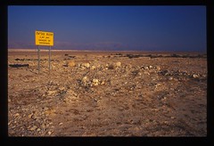
The Israeli spa resort of Ein Gedi used to lap the shores of the Dead Sea. The sea is now a kilometre away and the resort needs to bus its tourists to the shoreline. The falling sea level has left dangerous cracks in the surrounding terrain and roads, hotels and chemical plants in the vicinity are in danger of collapse. The water level has declined faster than ever since Israel took control of the water resources that feed the Jordan River after occupying the West Bank after the 1967 Arab/Israel war.
The Dead Sea is set in one of the largest fissures in the Earth’s surface – the 6,000km long Great Rift Valley. The Great Rift Valley is on the edge of a continental plate and is tearing Africa apart. It is moving Arabia and Eastern Africa away from the rest of the continent. It stretches all the way from the Taurus Mountains of Turkey to the Zambezi Valley in Mozambique. The valley is less than 100km wide and is up to several thousand kms deep. As well as the Dead Sea, the Rift is responsible for the Gulf of Aqaba, the Red Sea and the African Great Lakes.
The Dead Sea is mentioned in the Book of Genesis. It was known in Hebrew as Yam Hamelakh, the Salt Sea. The cities of Sodom and Gomorrah were on the southern shores of the Salt Sea. In the story of Sodom, God tells Abraham that he plans to destroy the city because of its immorality. But he agrees to spare the city if Abraham can find ten righteous people living. Abraham finds only one, Lot. God carries through his plans but angels tell Lot and his family to flee but not look back. When Lot's wife does look back, she is turned into a pillar of salt. Ancient traditions persist to this day hold that Lot's wife exists permanently as one of the pillar-like "salt mushrooms" that form on the Eastern shore of the Dead Sea.
 There are no angels willing to save the Dead Sea but the countries of Jordan, Israel and the Palestinian Authority have agreed on an ambitious new rescue plan for the waterway. The World Bank have issued a grant of $15m to investigate the feasibility of a canal from the Gulf of Aqaba, Jordan is leading the exercise as much of the infrastructure to support it, including salination plants and a hydro-electric facility, would be in that country. Ex-Israeli Prime Minister Shimon Peres said the three-country project had the potential to help the peace process. But not everyone is happy about the canal scheme. Friends of the Earth have warned mixing water from the Red Sea with the unique chemical soup of the Dead Sea could create a natural catastrophe. The Dead Sea’s mix of bromide, potash, magnesium and salt is unique and by bringing in marine water, this composition will change. There is concern about algae growth and how the two different chemical bodies will interact.
 But it is the only possible way the sea and its unique ecosystem will be saved. Jordan Valley Authority Secretary General Zafer Alem is optimistic the project will succeed despite the politics and environmental issues involved. He told the Jordan Times “the Dead Sea is a unique feature on this planet. It does not belong to Jordan, nor to the Palestinians, nor to Israel: It is part of world heritage”.